When I started writing Dundas Valley and Beyond, I included the “and Beyond” part to include those inevitable opportunities I would have to explore beautiful areas beyond the Dundas Valley and greater Hamilton area.
This week was one of those opportunities. Taking advantage of a few vacation days between Christmas and New Years, my family and I headed to Grand Island, New York for a few days of relaxation and shopping. Always looking for opportunities to hike, I discovered that Buckhorn Island State Park was only minutes from our hotel and made sure that an early morning hike into the park was part of the trip.
 Grand Island is an interesting place. At seven and a half miles long by six miles at its widest point, it is surprisingly small and yet it is one of the largest freshwater islands in the world.
Located at the southernmost point on the island, Buckhorn Island State Park and Wildlife Sanctuary consists of 895 acres of marsh, meadows and woods and the last vestige of the vast marshlands and meadows that once bordered the Niagara River. The public is welcome to hike the nature trails as well as bike, kayak, canoe, fish and cross-country ski in the park. Ongoing restoration continues to re-establish wetland cover and water levels and increase the diversity of native flora and fauna. The ongoing restoration plan includes increasing public access with more non-intrusive trails, overlooks and bird watching blinds.
Waking early, I was greeted by icy conditions and a light snow flurry. Heading into the park, it seemed like I had the entire area to myself and it was incredibly peaceful walking the snow covered trails that followed the Niagara River.
 This area was officially designated an Important Bird Area in December, 1996. Nineteen species of gulls have been found here, representing almost half of the world’s 45 species. The area is also on the migration route for 25 species of waterfowl. Many even overwinter along the river. The most numerous gulls found
 here are Bonaparte’s gull, ring-billed gull, and herring gull. The most common waterfowl to be found are greater scaup, common mergansers, and canvasbacks.
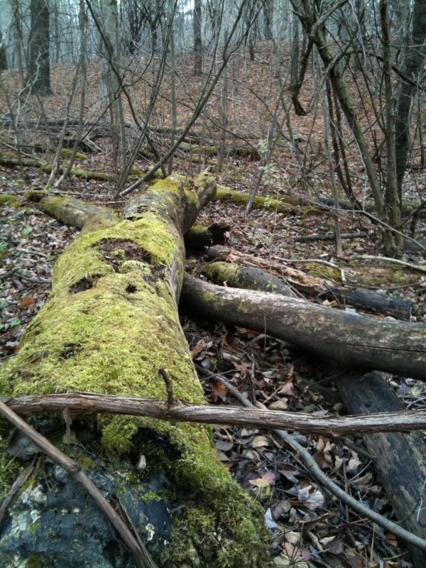
Walking the trails, I noticed that a high volume of trees were covered by climbing and interwoven clinging vines. It gave the forest an eerie “movie like” feel, particularly enhanced by the quietly falling snow. Along the water’s edge, icicles were forming on the low hanging branches.
 I was impressed with the many features of the park which included kayak launching areas and lookout platforms, ideal spots for bird watching.
Heading back to meet my family for breakfast, and with the ever present sound of migrating geese in the air, I felt a sense of gratitude for the year that was 2011. I am looking forward to an exciting 2012 and I hope you are too.
Thank you for taking the time to read my blog and please accept my sincere wishes for a happy and healthy 2012!
Thank you for taking the time to read my blog and please accept my sincere wishes for a happy and healthy 2012!
Cam

 The view is spectacular as you watch the water rush over the falls and into the Smokey Hollow Gorge. Great Falls, also known as Grindstone Falls, has a height of 10m (33 feet), and a crest width of 5m (16 feet).
  Visiting now, few clues remain to suggest that this stream was once so large and powerful that it supplied numerous mills with the power needed to operate heavy machinery. As late as 1890 Smokey Hollow was the site of two large mills, fourteen buildings, three houses and nine outbuildings. By 1912, however, the mills had all closed as the water level in Grindstone Creek had gone down and the steam engines that propelled the waterpower were acknowledged to be too dangerous. Today, thanks to a rehabilitation program implemented by Waterdown residents, the locality is a beautiful and well-kept park.
 As the Bruce Trail heads downstream of the falls, the views continue to impress with rocky outcroppings and ever changing photo opportunities as Grindstone Creek cascades through and over massive boulders. Watch your step on this trail as you experience many short ascents and descents, many with steps and tricky tree roots to navigate over.
 Easy to get to if hiking the Bruce Trail, the park can be found on the Waterdown section.
 Best wishes to you all for a very Merry Christmas!!!!

 Tiffany Falls is a 21 metre high (70 foot) cascade waterfall and has water flow all year, increasing in the spring or after a rain.
  Tiffany Falls Conservation Area is considered a significant natural area. Its bedrock exposures are considered an Earth Science Area of Regional Significance. The central feature of the conservation area is the two waterfalls within it, Tiffany Falls and Washboard Falls, formed by Tiffany Creek.
  The area provides a link between the greenspace corridor along the Niagara Escarpment through the Hamilton urban area, and the extensive natural areas of the Dundas Valley.
 On December 7, 2011, I had the privilege of joining Chris Ecklund, the man behind the City of Waterfalls and a group of volunteers as we hiked into the falls with high powered spotlights and temporarily illuminated the falls in blue light. The following pictures were taken that night.
 A special thank you to Jeanne Pickles for graciously sharing the following 2 shots.
 Tiffany Falls is located at the Tiffany Falls Conservation Area in Ancaster. To get there from Hwy 403 take the Lincoln Alexander Parkway exit and keep to the right to merge onto Rousseaux St. At the ‘T’ intersection turn right onto Wilson St. E. Park at Tiffany Falls Conservation Area and follow the trail to the waterfall.

 Crossing Cootes Drive, the trail enters the South Shore Trails of Cootes Paradise which is managed by the Royal Botanical Gardens.
 This trail continues to run between the West Pond and the shore of the creek leading you onto one of the largest rivermouth wetland deltas on Lake Ontario.
 This area is a significant part of the Niagara Escarpment World Biosphere Reserve and is home to more than 750 native plant species, 277 types of migratory birds, 37 mammal species, 14 reptile species, 9 amphibian species and 68 species of fish.
 As you walk deeper into this rich marshland, you can’t but help but notice how quiet it becomes and it amazes you that while so close to the city, this area remains tranquil and abundant in wildlife.
 Although beautiful at any time of year, the late fall and early winter provide the opportunity to view areas normally hidden by lush vegetation increasing the odds of viewing deer and other animals.
 I headed back from the trail determined to visit again in the summer, this time by kayak or canoe as water travel would provide even greater opportunities to explore. The Cootes Paradise Marsh is definitely an area I plan to visit again and again in the future.